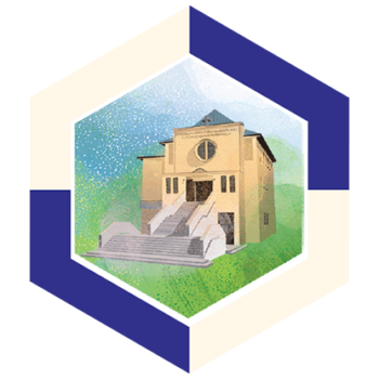
Bronowice


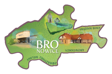 Bronowice - The name of the district comes from Bronowice Małe village on the outskirts of Kraków which belonged to St Mary’s parish for several centuries. Bronowice was first mentioned in 1244 in a document of the Abbot of Tyniec, which listed it as a farming commune together with Prądnik.
Bronowice was included within the fortifications around Kraków before the First World War, and was only made a part of the city during the German occupation in 1941. It became famous through Stanisław Wyspiański’s The Wedding, a play located in the Rydlówka manor house. The manor house of the Rydel family stands close to the Tetmajerówka mansion, a remnant of the 19th-c. fortifications of Kraków, while the Church of St Anthony replaced the former manor house of the archpresbyter of St Mary’s.
Czyzyny

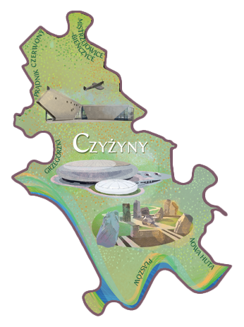 Czyżyny is the part of Nowa Huta closest to the historical centre of Kraków, famous for its former military airfield part of which is now the Polish Aviation Museum. No longer fulfilling its original function, it is a venue for the annual aviation picnics.
Names of monuments, streets, and entire neighbourhoods throughout the district make reference to aviation, and in its south part there is the spacious Polish Aviators Park, with the Stanisław Lem Science Garden, where you can experience the laws of physics.
The area is home to the Academy of Physical Education and some faculties of the Kraków Technical University, and the annual Czyżynalia event is a part of the Kraków students’ festival.
Czyżyny also boasts its own tongue-in-cheek castle: a residential block whose characteristic shape is modelled on Wawel Castle and, believe it or not, the city of Baghdad.
Debniki


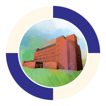
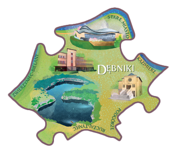 Debniki is a former suburban village situated near the Skałki Twardowskiego Rocks. The name comes from the tanning of hides (old Polish dębienie) or from oak wood (dębina). The district stretches over 10 miles and includes many former villages with their varied histories, and a landscape park. In 1910 it was included into the city of Kraków, and the Worker Settlement developed along today’s ul. Praska in 1935–38. During the Second World War, this neighbourhood was to be demolished and replaced with an ideal Nazi city, however the plans were never executed.
 After the war, in 1952, today’s Dębnicki Bridge replaced the one blown up by the Germans. It stands close to the even newer Grunwaldzki Bridge, which leads to Kazimierz. Many important buildings are situated at its Dębniki end: ICE Kraków Congress Centre, and, with the most attractive architecture, the Manggha Museum of Japanese Art and Technology.
Grzegorzki


 Grzegórzki. The first mention of this district comes from the late 14th c. It was the property of the city and also its larder. In the 19th c. industry developed here; both new factories and those transferred from the city centre, the largest being Zieleniewski’s factory that made heavy metal structures. In made Grzegórzki one of the most industrialised suburban, and later urban, neighbourhoods. In 1910 it became part of Kraków.
 The district boasts the Kraków Botanical Garden, and the trading exchange composed of the municipal covered market (Hala Targowa) and an open market. Food is still sold here during the week, while on Sundays it turns into a flea market with second-hand books and old bric-a-brac. This is also where you come after dusk for the legendary Sausages from the Blue Van (Kiełbaski z Niebieskiej Nyski).
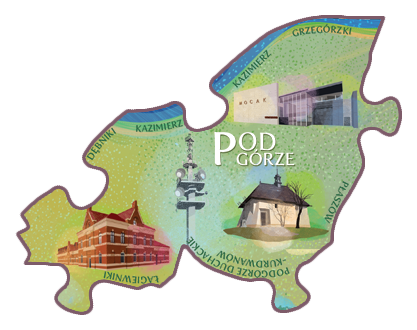
Kazimierz


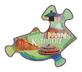 Kazimierz was a separate city until the 18th/19th centuries. Chartered in 1335 by King Casimir the Great, in its early years it was almost the same size as its neighbour, Kraków. The medieval built heritage includes the Old Synagogue, the Corpus Christi Church, the Church of St Catherine of Alexandria, and the Augustinian Monastery, one of the most beautiful and best-preserved Gothic complexes in Poland.
 Overlooking the Vistula is Skałka: the Church “on the Rock” with famous Poles buried in its vaults. Late in the 15th century, Jews began to settle in Kazimierz and developed an important cultural centre here. Among other buildings, they built seven synagogues, a complex that is unique on European scale. The Jewish settlement first focused around Szeroka Street, where the annual Jewish Culture Festival, with its Shalom in Szeroka finale, is now held.
Krowodrza


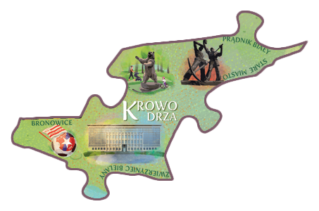 Krowodrza stretches from Jordana Park to Piastowska, Mickiewicza and Słowackiego streets, covering former villages, hamlets, pastures, and arable land. Krowodrza, one of the original villages, gave the district its name, while the others are commemorated in the street names.
 Part of Kraków since 1910, it contains the main buildings of the National Museum, the Jagiellonian Library, and the AGH University of Science and Technology that were built here between the two world wars. Nonetheless, well after the Second World War, it was still renowned for horticulture, mostly flowers and vegetables, while cows grazed on the Błonia Green.
Lagiewniki

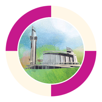
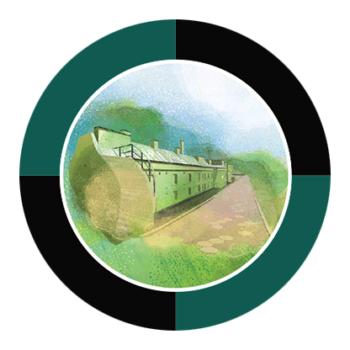
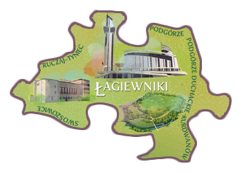 Łagiewniki has ul. Zakopiańska, connecting Kraków to the mountains, as its central axis. In the 19th and 20th c. it was an industrial area, including the Solvay soda works and a remnant of the time are heaps of by-products known as “the White Seas”.
 Today, Łagiewniki is an important religious and pilgrimage centre thanks to the modernist Sanctuary of Divine Mercy commemorating St Faustina Kowalska, and the post-modernist John Paul II Centre. The district also boasts one of the largest city green spaces: the Las Borkowski woods.
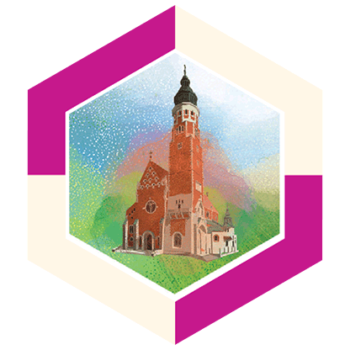
Mistrzejowice-Bienczyce
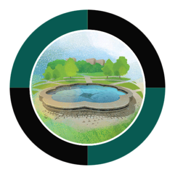
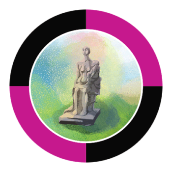
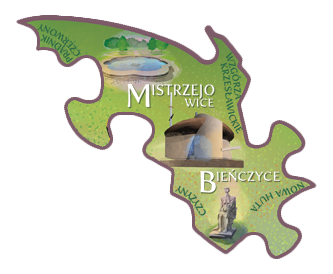 Mistrzejowice-Bieńczyce was incorporated into Kraków in 1951 as a neighbourhood of Nowa Huta. Mistrzejowice was developed in the 1960s and 1980s to the design of architect Witold Cęckiewicz.
 One of the most characteristic modern Kraków churches, known as the “Ark of the Lord”, was built in Bieńczyce in the 1960s/70s, mostly thanks to the effort of the then Archbishop of Kraków, Karol Wojtyła, later Pope John Paul II. The area around the churches in the two districts were the battlegrounds of Nowa Huta’s Solidarity anti-communist grassroots movement in the 1980s.
Nowa Huta

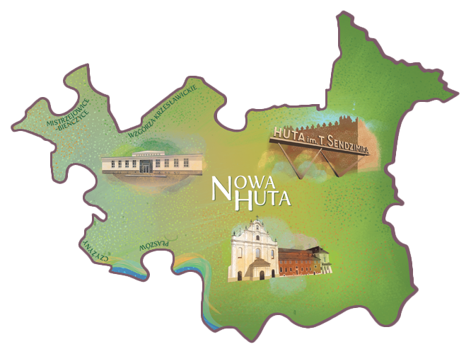 The construction of Nowa Huta began in 1949, starting with the delineation of the Central Square followed by the surrounding residential estates. Its main designer, Tadeusz Ptaszycki, spared no effort of the imagination and turned it into a prime example of socialist realism.
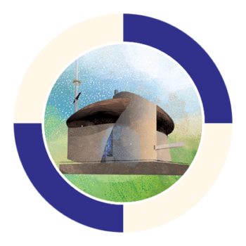
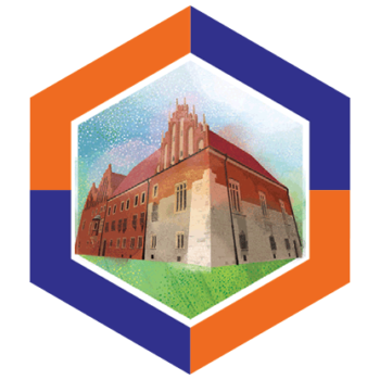
 In 1951 Nowa Huta was incorporated into Kraków, although for long after many considered it a separate city. Its history, and the fact that it is a unique example of greenfield communist urban design, attract many tourists. This industrial settlement built on the most fertile lands includes the village of Mogiła, owned since the 13th c. by the Cistercian Abbey. Its medieval complex includes (on the other side of the street) the Church of St Bartholomew: the oldest and best preserved wooden church in Kraków.
Plaszow


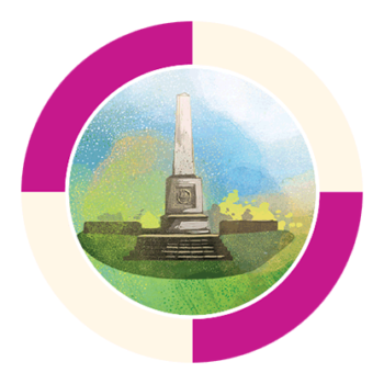
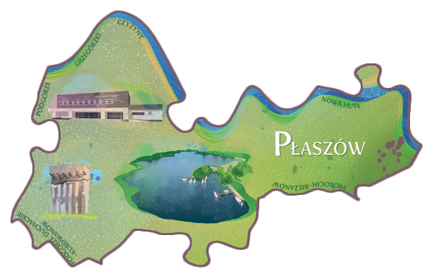 Płaszów was first mentioned in 1254. In 1855 the village was intersected by the Kraków–Lwów railway line, and the station opened in 1884. This encouraged industrial development that soon turned the rural area into an industrial hub.
 Płaszów is remembered for the KL Plaszow concentration camp established here by the Nazi Germans. Towering over the camp is the massive concrete Plaszow Memorial, and nearby is the Liban Limestone Quarry. On the other side of the railway line is the Bagry Reservoir; one of the largest bodies of water in Kraków. In the heat of the summer it attracts crowds of breeze-thirsty locals and fans of water sports.
Podgorze


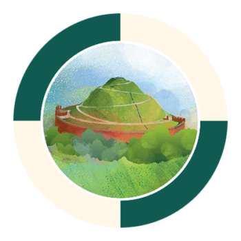
 Podgórze was proclaimed as a free city on the power of a decree of Emperor Joseph II in 1784. The imperial privileges, its location on trading routes, and the privileges granting it religious freedom allowed it to develop into an independent hub. Kraków and Podgórze were eventually united on 4 July 1915. Podgórze has the mysterious Krakus Mound, built in or before the 8th century, in its symbolical centre, and the Podgórski Cemetery on its slopes is an important Kraków necropolis. On its other side, the unique St Benedict Fort, a remnant of the Kraków Fortress, stands on Lasoty Hill, with the diminutive Gothic Church of St Benedict nestled on the nearby limestone ridge. Krzemionki rock is topped by the headquarters of Kraków TV with its tower, one of the highest points in the city.
 Old Podgórze stretches out below Krzemionki, with the market square and the neo-Gothic Church of St Joseph at its centre. Across the road is the edge of the former Kraków Ghetto set up by the Nazis. It is commemorated by the monument with empty chairs in Plac Bohaterów Getta square, where the Pharmacy “Under the Eagle”, now a museum, operated during the war. Memory of the Shoah is also maintained by the museum now located in the Oskar Schindler Enamel Factory, behind which is the MOCAK Museum of Contemporary Art Kraków.
Podgorze Duchackie-Kurdwanow


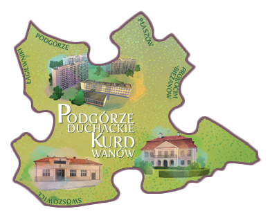 Podgórze Duchackie-Kurdwanów is one of the highest and most densely developed residential districts. It includes Piaski Wielkie, an area that became famous in the second half of the 19th c. for its slaughterhouses and meat processing establishments.
 The meat trade thrived here, and the local guerrilla butchers sold their produce tied to long sticks to avoid the guild rules in Kraków, earning themselves the nickname of “stick men” (Kijaki Piaszczańskie). They started their own guild, and in the 1930s they built its headquarters, a building preserved to today.
Pradnik Bialy


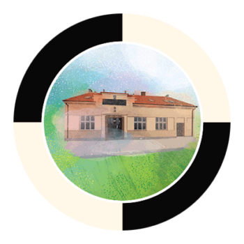
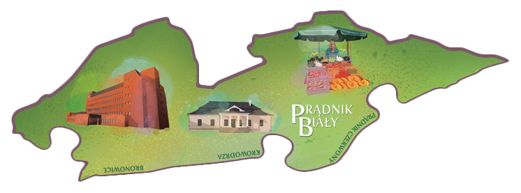 Prądnik Biały was the property of Kraków bishops since the early Middle Ages. In the 13th century, Bishop Iwo Odrowąż bequeathed it to the Order of the Canons of the Holy Spirit de Saxia, popularly known as Zakon Duchaków, who made it their home.
 The Kraków bishops built their suburban residence here in the 16th century and hosted eminent figures of the Polish Renaissance. Repeatedly destroyed, the manor house was replaced by a new one in the 19th century, which now operates under the name of Dworek Białoprądnicki Culture Centre.
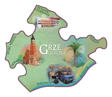
Pradnik Czerwony


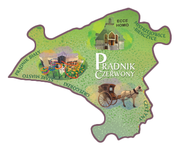 Prądnik Czerwony was first mentioned in the 12th century as one of the demesnes of the estates of the Abbey in Tyniec. In the 15th c. Kraków monasteries began to set up their granges here and a century later, noble families began to build their manor houses in the area.
 The most important built heritage of the district includes the Manor House in Olsza, built by the Carmelites in the 18th c. and owned by the Potocki family, and the smaller Pocieszka manor house, which started as a Renaissance mansion of the Cellari brothers. Its visitors included the kings of Poland Ladislaus IV and John Casimir.
Prokocim-Biezanow


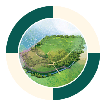
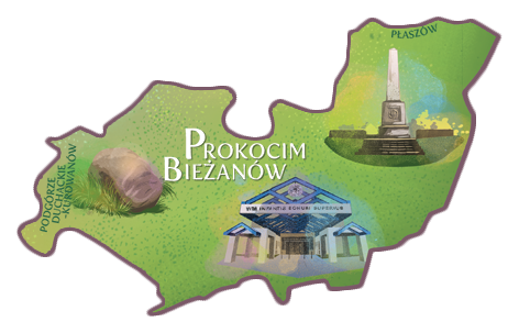 Prokocim-Bieżanów is situated by the Wieliczka road that was staked out in the 18th century, yet the beaten track had served the salt trade much earlier. The nearby Obelisk on Kaim Hill marks the furthest incursion of the Russian army into Galicia in 1915 during the First World War.
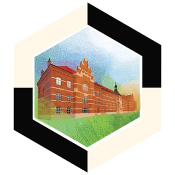
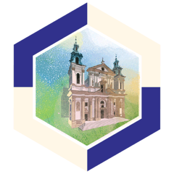
 The original manor house of Prokocim was replaced in the late 18th c. by the mansion known as the Jerzmanowski manor house, and the surrounding park, with its many old trees, is named after Anna and Erazm Jerzmanowski. After their deaths, the estate was purchased by the Augustine Order who raised the extant church of Our Lady of Good Counsel, designed by Adolf Szyszko-Bohusz. One of the most remarkable burial grounds of Lusatian culture (1300–500BC), with 500 urns with decorations, was discovered nearby in 1925. The district is also the headquarters of the University Hospital.
Ruczaj-Tyniec
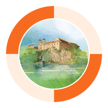

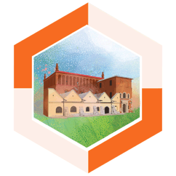
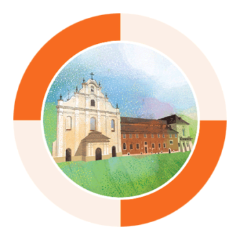
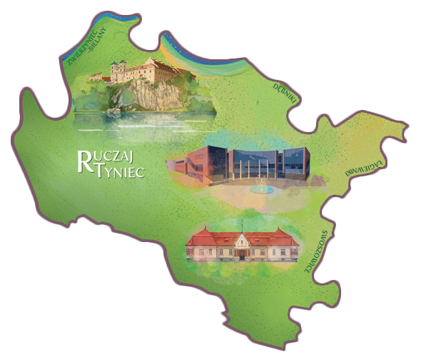 Ruczaj-Tyniec. Tyniec is an ancient village famous for its 11th-c. Benedictine Abbey. In 1816, Austrians occupying the area dissolved the Order and emptied the Abbey, and in 1831 the complex burnt down. The Benedictines returned to Tyniec from Belgium in August 1939, but the reconstruction of the monastery to the design of Adolf Szyszko-Bohusz was interrupted by the Second World War.
 The process of returning the former splendour to the complex on the rocky promontory eventually began in 1947–53 and still continues. In turn, Ruczaj is one of the most intensively developing areas of today’s Kraków.
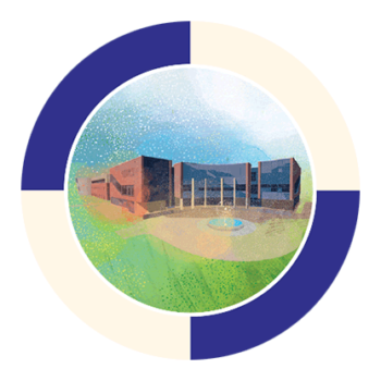
Home to the 3rd Campus of the Jagiellonian University and the Kraków Technology Park, it is also the place where numerous Polish and international businesses drawing from the local academic potential have established their headquarters. The nearby clinical psychiatric hospital in Kobierzyn was at the avant-garde of psychiatric hospital design and treatment when it was built 120 years ago. During the Second World War, the Germans murdered its patients, turned it into military barracks and a hospital, and the village into a penal POW camp.
Swoszowice


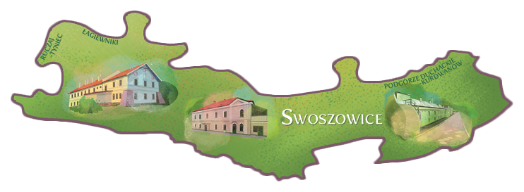 Swoszowice is the southernmost district of Kraków, and its history is bound to sulphur deposits. Discovered in 1422, the mineral was mined since the 15th c. on the power of a royal charter.
 Mining reached its peak in the 1860s, and today Swoszowice is mostly known for its curative sulphur waters and muds. The springs and the surrounding park make Swoszowice Poland’s only active spa situated within a metropolis. Even though the first mention of the healing properties of the local waters date back to the 16th century, it has only operated since 1811.
The City Centre
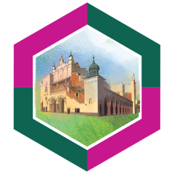

 The City Centre is the area where the oldest and most important built heritage of Kraków is found. These buildings witnessed the key moments in the history of the city: the Main Market Square, the Cloth Hall, Wawel with the Royal Castle and Cathedral, many churches with the outstanding St Mary’s at the fore, and the original campus of the Jagiellonian University incorporated by King Casimir the Great with the Collegium Maius and Collegium Novum.
 The area is very much alive and the Main Market Square’s central function continues as it has since it was staked out in 1257, via the Prussian Homage of 1525, and the oath sworn by Tadeusz Kościuszko in 1794. The exceptional atmosphere of the district makes it a favourite destination for locals and tourists from around the world.
Wzgorza Krzeslawickie


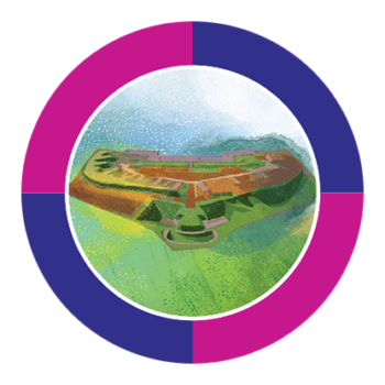
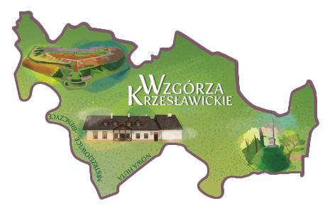 Wzgórza Krzesławickie Hills. The history of Krzesławice is very varied: it belonged to the university, then to Hugo Kołłątaj, and then to Jan Matejko.
 The Krzesławice Fort built here late in the 19th c. belongs to the Kraków Fortress system, while its brickworks produced material for the construction of the Lenin Steelworks in the second half of the 20th c. The attractions of the district include the early 19th-c. Manor House of Jan Matejko, and Krzesławice Fort No. 49.
Zwierzyniec-Bielany


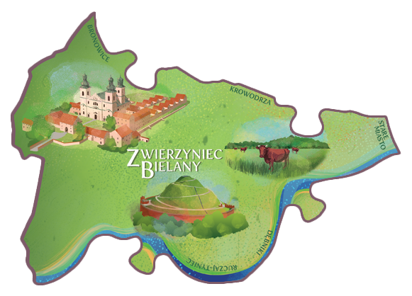 Zwierzyniec-Bielany. The district covers many former suburban hamlets and villages boasting a long and rich history, with Bielany being strongly connected to the Premonstratensian (Norbertine) Abbey that was built for the Order, brought here by Jaksa of the Gryf coat of arms in the 12th c. An important destination on the map of the district is the mound raised on Sikornik Hill in the 19th c. to commemorate Tadeusz Kościuszko.
 Zwierzyniec is also the location of the Błonia Green, the former pastures of the Premonstratensian Monastery. Zwierzyniec is the district with most greenery, and it also has plentiful built heritage, including the Church of the Holy Saviour, the Premonstratensian Convent, and the early industrial waterworks. In turn, Bielany was made famous by the Church and Hermitage of the Camaldolese Order.